
Agricultural Drones and Robotics: Revolutionizing Farming
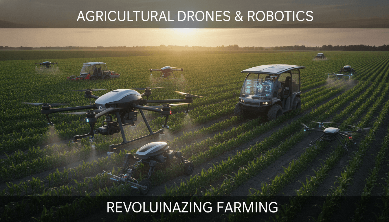
Autonomous aircraft and ground robots are changing what's possible on a farm. Here's a technical look at how these systems work, where they genuinely help, and what the integration challenges look like in practice.
How Do Agricultural Drones Actually Work at Scale?
A single drone doing a field survey is a proof of concept. A coordinated fleet covering 500 hectares before sunrise is an operational system, and the engineering behind it is considerably more involved.
Most commercial agricultural drones fall into two categories: fixed-wing platforms for large-area mapping and multirotor platforms for precision application. Fixed-wing drones like the senseFly eBee X can cover up to 500 hectares per flight at 122 m altitude. Multirotors like the DJI Agras T40 carry a 40-litre tank and deliver pesticide or fertiliser at roughly 40 hectares per hour with centimetre-level placement accuracy using RTK-GPS.
Sensors and Payloads
The drone is just the carrier. The value sits in the payload:
- Multispectral cameras (e.g., MicaSense RedEdge-P) capture reflectance in five to ten bands, letting you derive indices like NDVI, NDRE, and NDWI. These indices flag stress, nitrogen deficiency, and moisture variation well before visible symptoms appear.
- LiDAR (e.g., Velodyne VLP-16) produces centimetre-accurate terrain models used for drainage planning and variable-rate application maps.
- Thermal cameras identify irrigation leaks and crop disease hotspots by surface temperature delta.
- Hyperspectral sensors go further, discriminating between pest species and disease strains, though the data volumes are large and processing pipelines are non-trivial.
Fleet Coordination
Running multiple drones simultaneously requires a ground control system that handles collision avoidance, dynamic re-tasking when a drone needs to return for battery swap, and real-time telemetry aggregation. DJI FlightHub 2 and Autel's enterprise platform handle this for homogeneous fleets. Heterogeneous fleets, mixing brands or fixed-wing and multirotor, typically need a custom middleware layer built on MAVLink or DroneKit, or increasingly on ROS 2 with PX4 or ArduPilot as the autopilot firmware.
Battery logistics is the unglamorous constraint. A DJI Agras T40 runs roughly 15 minutes per charge under load. For continuous operation you need a hot-swap station cadence that matches application rate to field coverage, and that cadence has to be planned in software, not on the fly.
What Ground Robots Are Actually Deployed on Farms Today?
Ground robots are further behind drones in commercial adoption, but several platforms have cleared the prototype stage.
The Naio Technologies Oz robot handles mechanical weeding in row crops at roughly 0.5 hectares per hour, navigating by RTK-GPS and computer vision. It requires 6 cm row spacing consistency, which means the seeding pass has to be precise or the robot derails. That upstream dependency is a common integration problem.
The EarthSense TerraSentia platform is a scouting robot that moves under the canopy, taking per-plant images to count ears, measure stalk diameter, and detect lodging. It pushes data to a cloud pipeline where a CNN model produces stand counts and yield estimates. Correlation with actual yield monitor data from the combine is typically within 5%.
Fendt's Xaver concept and the Small Robot Company's Tom, Dick, and Harry system take a different architecture: swarm micro-robots, each handling individual plants rather than rows. The idea is that many small, light robots cause less soil compaction than a single heavy machine, which is agronomically significant. A 10-tonne tractor compacts soil to 60 cm depth; a 20 kg robot does not. The tradeoff is coordination complexity and per-unit maintenance overhead.
/// Not sure where to start?
Get the architecture before you commit
Tell us what you're building and we'll map the technical approach, stack, and rough timeline. No cost, no obligation, no sales call required.
Integrating Drone and Robot Data Into a Farm Management System
Collecting data is the easy part. Making it actionable is where most implementations fall short.
A typical data flow looks like this:
- Drone flight generates raw imagery (40–80 GB per 100 hectares for multispectral).
- Photogrammetry software (Pix4Dfields, Agisoft Metashape, or OpenDroneMap for open-source) stitches and orthorectifies into a georeferenced raster.
- Band math produces vegetation index maps.
- Those maps feed a variable-rate application (VRA) prescription, formatted as a shapefile or ISO-XML task, depending on what the field controller accepts.
- The prescription is uploaded to the tractor's ISOBUS-compatible terminal.
- After application, actual-as-applied data comes back from the machine's section control logs and closes the loop.
The failure points are almost always in steps 4 and 5. ISOBUS (ISO 11783) is the standard, but implementation varies significantly between terminal brands. What Trimble accepts as valid ISO-XML is not always what John Deere Operations Center passes without complaint. If you're building a farm management system that needs to talk to multiple terminal brands, plan for a translation layer and budget time for field testing on real hardware.
Data Storage and Latency
Field edge computing matters here. Uploading 80 GB of raw imagery over a 4G connection at field edge is impractical. The common pattern is local processing on a ruggedised edge device (NVIDIA Jetson AGX Orin is popular for this) to produce a compressed index map, then uploading only the derived data. Raw imagery stays local until the machine returns to a location with decent connectivity.
How Accurate Is AI-Based Crop Analysis, and Where Does It Break Down?
Computer vision models for crop disease detection have published accuracy numbers that sound impressive. A 2023 paper in Computers and Electronics in Agriculture reported 97.3% accuracy for identifying 14 common diseases in maize using a ResNet-50 architecture trained on PlantVillage data. That number deserves scrutiny.
PlantVillage images are taken in controlled conditions against plain backgrounds. Field images have variable lighting, occlusion, motion blur, and mixed disease presentations. Transfer learning from PlantVillage to field conditions typically sees accuracy drop to 70–85% without significant domain adaptation work.
The honest position: models trained on controlled datasets are a starting point, not a finished product. Useful field performance requires:
- A labelled dataset from the target geography and crop variety (climate and cultivar affect how disease presents visually).
- Regular retraining as new seasons introduce distribution shift.
- A confidence threshold below which the model flags for human review rather than generating an automatic prescription.
That last point is important from a liability standpoint. Misclassifying a fungal infection as bacterial leads to the wrong fungicide application, crop damage, and a farmer dispute. The system needs a human in the loop for low-confidence predictions.
| Model architecture | PlantVillage accuracy | Field accuracy (typical) | Inference time (Jetson AGX Orin) |
|---|---|---|---|
| ResNet-50 | 97.3% | 72–80% | ~18 ms |
| EfficientNet-B4 | 96.8% | 75–83% | ~22 ms |
| YOLOv8-S (detection) | 94.1% | 78–85% | ~9 ms |
Regulatory Constraints That Shape System Design
Drone regulations directly constrain what you can build, and they vary by country in ways that matter architecturally.
In India, the Directorate General of Civil Aviation (DGCA) Remote Pilot Aircraft System (RPAS) rules require a Unique Identification Number (UIN) and Remote Pilot Licence for drones above 250 g. Agricultural drones typically fall in the Medium category (2–25 kg MTOW). Beyond Visual Line of Sight (BVLOS) operations, which are essential for autonomous multi-field coverage, require a case-by-case BVLOS waiver. That waiver process is slow, and designing a system that assumes BVLOS approval is a planning risk.
In the EU, EASA's UAS regulations place agricultural spray drones in the Specific category, requiring an operational authorisation. The U-space framework is being built out to support automated drone operations at scale, but full implementation is still in progress across member states.
The practical consequence: if you're building a fleet management system for a market where BVLOS approval is uncertain, you need a fallback operational mode that works within VLOS, even if it reduces coverage efficiency.
Conclusion
The technology stack for agricultural drones and ground robots is mature enough to deploy at commercial scale, but integration is still genuinely hard. Sensors are reliable. Autopilots are reliable. The gaps are in data pipelines, terminal compatibility, AI model robustness under field conditions, and regulatory uncertainty around autonomous operations.
If you're evaluating a build for precision agriculture, start with a constrained scope: one crop type, one geography, one terminal brand. Get the data loop closed end-to-end before expanding. The engineering complexity scales faster than most teams anticipate.
Reach out to Sodio's engineering team if you want to talk through architecture for a specific deployment context.
Frequently Asked Questions
How much does it cost to deploy a commercial agricultural drone fleet? A single DJI Agras T40 costs approximately USD 23,000. A workable operational unit, one spraying drone, one mapping drone, a hot-swap charging station, and fleet management software, runs USD 40,000 to 70,000 before ground operations costs. ROI depends on crop value and current application costs; high-value horticultural crops typically justify the investment faster than commodity grain.
Can agricultural drones operate in all weather conditions? Most commercial spray drones are rated for wind speeds up to 8–10 m/s and have an ingress protection rating of IP43 to IP54, meaning light rain is tolerable but not heavy rain. Flying in wind above the rated limit degrades placement accuracy significantly. Cold temperatures below 5°C reduce LiPo battery capacity by 20–30%, cutting flight time.
What connectivity infrastructure does a farm need to support autonomous robots? RTK-GPS correction data requires either a local base station (within 10 km for centimetre accuracy) or a subscription to a network RTK service. 4G connectivity is helpful for real-time telemetry but not strictly required if the robot has onboard processing. Many systems operate in a store-and-forward mode, syncing data when connectivity is available.
How do variable-rate application maps get from a drone to a tractor? The drone mission produces a vegetation index map, which is converted to a prescription map in a format the tractor's terminal accepts, typically ISO-XML for ISOBUS-compliant systems. The file transfers via USB, WiFi, or through a farm management platform's cloud sync. The tractor's section control then modulates application rate per GPS position as it moves through the field.
Is there a minimum farm size where drone-based scouting makes economic sense? As a rough guide, farms above 50 hectares typically see positive economics on drone scouting when crop value exceeds USD 500 per hectare. Below that threshold, the capital and operational costs of a drone programme are difficult to recover versus manual scouting. Contracting a drone service provider rather than owning hardware is the lower-risk entry point for smaller operations.
Have a project in mind? Contact Sodio Technologies to discuss your requirements and explore the right technology solution for your business.
/// Work with us
Talk to the engineers who'd build it
You'll get a technical scope, timeline and cost estimate from the people doing the work, not an account manager. In-house team, no subcontracting, since 2016.