

How to Make an App Like Pawtrack
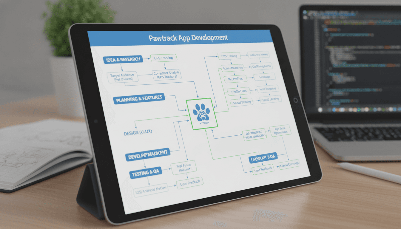
Building a GPS pet tracker app is more involved than it looks. The hardware-software boundary, the real-time location pipeline, and the subscription billing model all carry hidden complexity. This post walks through what it actually takes to build something like Pawtrack — architecture decisions, trade-offs, and rough cost drivers included.
What Does Pawtrack Actually Do Under the Hood?
Pawtrack is a GPS collar tracker for cats. The collar contains a GPS module and a cellular modem (typically using a low-power LTE-M or NB-IoT SIM). Every few seconds, it pushes a location packet to a cloud backend. The mobile app then pulls or receives that position and renders it on a map.
That sounds simple. The complications are in the details.
The collar must balance location accuracy against battery life. Full GPS fixes are power-hungry. Pawtrack's device runs roughly 2–7 days on a charge depending on update frequency, which is typical for LTE-M GPS trackers. You are always trading off fix interval against battery longevity.
On the backend, you are handling a real-time telemetry stream. Each device sends packets at configurable intervals — say every 10 seconds when moving, every 5 minutes when stationary. At 10,000 active devices, that is up to 1,000 messages per second. Your ingestion layer needs to handle that without dropping packets, and your storage layer needs to handle time-series data efficiently.
What Does the Technical Stack Look Like?
Hardware and Connectivity
You are not building the hardware from scratch unless you want to spend 18–24 months in firmware development. The realistic path is working with an ODM (Original Design Manufacturer) who produces a GPS + LTE-M module you can white-label, or sourcing a reference design and customising it. SIM management goes through an eSIM provider like Eseye, Twilio Super SIM, or a regional IoT MVNO.
The firmware on the device handles:
- GPS fix acquisition and AGPS (Assisted GPS to reduce cold start times from ~30 seconds to ~2 seconds)
- Power state management (sleep cycles, motion detection via accelerometer)
- Cellular connection management and reconnection logic
- Packet serialisation, typically using Protocol Buffers or a lightweight binary format rather than JSON to reduce payload size and data cost
Backend Architecture
The backend splits into two parts: the telemetry ingestion pipeline and the application API.
For telemetry ingestion, MQTT is the standard protocol. It is lightweight, supports QoS levels 1 and 2 for guaranteed delivery, and is well-supported by brokers like HiveMQ, EMQX, and AWS IoT Core. AWS IoT Core is the path of least resistance if you are already on AWS — it handles device authentication via X.509 certificates, scales automatically, and routes messages to downstream services via rules.
From the broker, messages go into a stream processor. Apache Kafka or AWS Kinesis works here. Kafka gives you more control and lower per-message cost at scale; Kinesis is easier to operate. A consumer service reads from the stream, validates packets, and writes to your time-series store.
For time-series storage, TimescaleDB (PostgreSQL extension) is a solid choice up to tens of millions of rows per day. Beyond that, InfluxDB or AWS Timestream scales better for pure time-series queries. For geospatial queries — "show me all locations within this polygon" — you need PostGIS or a dedicated geospatial index.
The application API is a standard REST or GraphQL service. It serves the mobile app: current location, location history, geofence configuration, alerts, account management.
Geofences and Alerts
Geofencing is where a lot of teams underestimate the work. A geofence is a polygon stored in PostGIS. When a new location packet arrives, you evaluate whether the device has crossed a boundary since the last packet. If the fix interval is 10 seconds and the animal is moving at 5 km/h, it will travel roughly 14 metres between fixes. A small geofence (say, 20-metre radius) can be entered and exited between fixes — you will miss the event.
Solutions: reduce fix interval when the device is near a known geofence boundary, or accept that small geofences will have missed events. Both are valid depending on the use case.
Push notifications for alerts go through APNs (Apple) and FCM (Google). Use a service like Firebase Cloud Messaging, which abstracts both, unless you have a reason to call each directly.
/// Not sure where to start?
Get the architecture before you commit
Tell us what you're building and we'll map the technical approach, stack, and rough timeline. No cost, no obligation, no sales call required.
Mobile App
The mobile app is the user-facing product. React Native is a reasonable choice here — one codebase for iOS and Android, and the GPS map rendering via Mapbox or Google Maps SDK works well in React Native. Flutter is the other option; it performs slightly better on animation-heavy UIs, but the mapping ecosystem is less mature.
The map view needs to:
- Show real-time position, updating as packets arrive
- Render location history as a path (a GeoJSON LineString)
- Allow geofence creation via polygon drawing on the map
- Handle offline gracefully — show last known position, not a blank screen
Real-time updates on mobile: use a WebSocket connection to the backend or Server-Sent Events. WebSockets have lower overhead for bidirectional communication; SSE is simpler if you only need server-to-client push. At the scale Pawtrack operates, either works.
How Much Does It Cost to Build?
This depends heavily on how much of the hardware layer you are building versus buying. Assuming you are sourcing hardware from an ODM and building only the software:
| Component | Rough build effort |
|---|---|
| Backend (ingestion + API) | 10–14 weeks (2 engineers) |
| Mobile app (iOS + Android) | 10–12 weeks (2 engineers) |
| Admin dashboard | 4–6 weeks (1 engineer) |
| DevOps / infrastructure | 4–6 weeks (1 engineer) |
| QA and integration testing | Ongoing throughout |
Ongoing infrastructure cost at 10,000 active devices, assuming AWS: roughly $2,000–$4,000/month depending on fix interval and data retention period. IoT Core pricing is $0.08 per million messages; Kinesis is $0.015 per shard-hour. Storage is cheap; compute for the consumer services is the bigger variable.
What Are the Real Trade-offs?
LTE-M vs NB-IoT: LTE-M has lower latency and supports VoLTE, which you do not need for a tracker. NB-IoT has slightly better building penetration and lower device power consumption in stationary mode. For a pet tracker used mostly outdoors, LTE-M is usually the better fit because the higher data rate keeps cold start times manageable.
Self-hosted MQTT vs managed IoT service: HiveMQ or EMQX on your own infrastructure gives you more control over connection handling and lower message costs at high scale. AWS IoT Core is simpler to operate and adds managed device provisioning and shadow state. For a new product, start with IoT Core and migrate if costs become material.
Subscription model: Pawtrack charges a monthly SIM fee. You will carry the SIM cost yourself (roughly $0.50–$2.00/device/month for LTE-M depending on data volume and provider) and mark it up. Factor this into your pricing model early — it is a recurring COGS item that compounds.
Conclusion
Building a pet tracker app is a full IoT product problem: firmware (or ODM selection), a real-time telemetry pipeline, geospatial processing, and a mobile app, all tied together with a subscription billing model. None of the individual pieces are exotic, but they span enough domains that teams routinely underestimate the integration work.
If you are scoping this out, start with the hardware decision. Everything downstream — connectivity, backend architecture, battery life expectations — flows from the module you pick.
If you want to talk through architecture specifics or get a realistic build estimate for your variant of this product, reach out to the team at Sodio.
FAQ
How long does it take to build a GPS pet tracker app? Software-only (assuming ODM hardware), expect 6–9 months to a production-ready v1 with a small team of 4–5 engineers. That includes backend, mobile app, admin tooling, and QA. Hardware development, if you are building your own device, adds 12–18 months minimum.
What connectivity technology should a pet tracker use? LTE-M is the standard choice for outdoor pet trackers. It balances latency, power consumption, and global coverage. NB-IoT is worth considering if your primary market has strong NB-IoT coverage and your animals are frequently indoors or stationary for long periods.
How do you handle real-time location updates in the mobile app? A WebSocket connection from the app to the backend works well for most scales. The backend pushes a new position packet to the connected client whenever the device sends one. Server-Sent Events is a simpler alternative if you only need one-directional push.
What database should you use for GPS track storage? TimescaleDB (a PostgreSQL extension) with PostGIS for geospatial indexing covers most use cases up to tens of millions of rows per day. It keeps your stack in PostgreSQL, which your application API is probably already using. Migrate to InfluxDB or Timestream if query performance degrades at scale.
Can you build a pet tracker app without building the hardware? Yes. ODMs in China and Taiwan produce GPS + LTE-M modules designed for white-labelling. You customise the enclosure, firmware configuration, and potentially the firmware itself, then focus your engineering effort on the cloud and mobile layers. This is the fastest path to market for a software-led team.
Have a project in mind? Contact Sodio Technologies to discuss your requirements and explore the right technology solution for your business.
/// Work with us
Talk to the engineers who'd build it
You'll get a technical scope, timeline and cost estimate from the people doing the work, not an account manager. In-house team, no subcontracting, since 2016.