

How to Make an App Like Life360
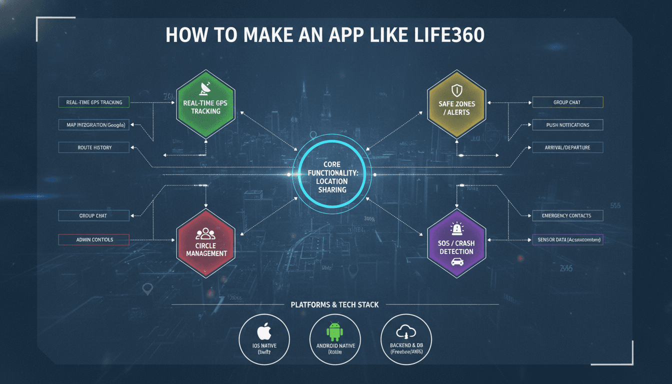
Building a family location-sharing app sounds deceptively simple — GPS coordinates, a map, some notifications. The reality involves real-time data pipelines, battery-aware location strategies, privacy controls that hold up under scrutiny, and a monetisation model that doesn't alienate users. This post walks through the architecture and engineering decisions behind a Life360-equivalent, for teams that want to understand what they're actually building before they start.
What Does Life360 Actually Do Under the Hood?
Life360 has roughly 66 million monthly active users as of 2024. The core product tracks device locations, displays them on a shared map, sends alerts on arrival and departure, and detects driving events like hard braking and speeding. There's also a safety layer: crash detection, 24/7 roadside assistance, and in some tiers, identity theft protection.
From an engineering perspective, the product breaks into four distinct systems:
- Location collection and transmission from device to backend
- Real-time aggregation and storage of location events
- Geofence evaluation and alert dispatch
- Telematics processing for driving behaviour
Each of these has different scaling characteristics, different latency requirements, and different battery/data trade-offs. You need to design them separately even if they share infrastructure.
What's the Right Location Strategy for Battery Life?
This is where most teams make their first mistake. Polling GPS continuously kills a battery in four to six hours. Life360 uses a combination of GPS, Wi-Fi positioning, and cell tower triangulation, switching between them based on motion state. When a device is stationary, cell towers are enough. When it starts moving, the app steps up to GPS. This is called adaptive location sampling.
iOS vs Android Implementation
On iOS, you're working with CLLocationManager. The key APIs are startUpdatingLocation for active tracking, startMonitoringSignificantLocationChanges for low-power background tracking, and startMonitoring(for:) for geofences. Apple caps you at 20 simultaneous geofences per app, which forces you to be selective about which ones you register.
On Android, the Fused Location Provider API (part of Google Play Services) handles the sensor fusion automatically. You set a priority — PRIORITY_HIGH_ACCURACY, PRIORITY_BALANCED_POWER_ACCURACY, or PRIORITY_LOW_POWER — and the system picks the best available source. For background work, you'll use WorkManager with a foreground service for persistent tracking, since Android 8.0+ aggressively limits background execution.
Neither platform makes continuous background tracking easy. You'll spend a significant portion of development time on edge cases: app kills, Doze mode on Android, iOS backgrounding restrictions, and OEM-specific battery optimisation tools (Xiaomi and Huawei are particularly aggressive).
Data Transmission
Don't send every GPS fix to your server. Batch fixes client-side and upload on a schedule or when the device connects to Wi-Fi. A reasonable default is a 30-second fix interval with a 5-minute upload batch. For high-accuracy mode (driving detection), you might drop to 5-second intervals and stream via WebSocket.
How Do You Build the Real-Time Backend?
Location data is a high-velocity, low-value-per-event stream. You need an architecture that can ingest millions of events per minute, evaluate geofence conditions, and push updates to family members with sub-second latency.
/// Not sure where to start?
Get the architecture before you commit
Tell us what you're building and we'll map the technical approach, stack, and rough timeline. No cost, no obligation, no sales call required.
Ingestion and Processing
Apache Kafka is the standard choice for the ingestion layer. Events arrive at a Kafka topic partitioned by user or family group ID. A stream processor (Apache Flink or Kafka Streams) consumes the topic, evaluates geofence entry/exit conditions, detects motion state changes, and emits alert events to a separate topic.
For geofence evaluation, the naive approach of checking every active geofence against every location update doesn't scale. You need a spatial index. An R-tree or a geohash-based lookup narrows the candidate set before running precise polygon intersection tests. PostGIS handles this well if your geofence count is in the millions; for anything smaller, a simpler in-memory structure is fine.
Storage
Location history is time-series data. TimescaleDB (built on PostgreSQL) is a practical choice that gives you SQL familiarity with time-series optimisations like automatic partitioning and compression. For the live location state (the current position of each family member), a Redis hash per family group works well — reads are fast and the data structure is simple.
Push notifications go through APNs (Apple) and FCM (Google). For geofence alerts, you want delivery within a few seconds of the event. Build a retry layer with exponential backoff; both platforms return delivery failures you need to handle.
WebSockets for Real-Time Map Updates
The family map view needs live updates. Long-polling works but is inefficient. A WebSocket connection from the app to a gateway (you can use Socket.IO, native WebSockets, or a managed service like Ably or Pusher) lets you push location updates as they arrive. For a small user base, a single Node.js or Go gateway handles this fine. At scale, you need a pub/sub layer (again, Kafka or Redis Pub/Sub) so that any gateway instance can push to any connected client.
Geofencing, Alerts, and Driving Detection
Geofences in Life360 are circular (centre point plus radius, minimum 100 metres or so). Polygon geofences are more accurate but more expensive to evaluate and harder to draw on mobile. Stick with circles unless you have a specific reason not to.
Driving detection uses the accelerometer and gyroscope data fused with GPS speed. Hard braking is typically defined as a deceleration event exceeding 0.4g over a short window. Speeding is straightforward — GPS speed against a posted limit from a road network dataset like HERE Maps or OpenStreetMap's speed limit data. Crash detection is harder; it requires a trained model on IMU data patterns, and false positives have real consequences (triggering emergency calls unnecessarily). Life360 acquired Tile and Jiobit partly for their sensor expertise. If you're building this feature, plan for a significant ML investment or licence a third-party telematics SDK like Cambridge Mobile Telematics.
Privacy Architecture You Can Actually Defend
Location data is sensitive. You need more than a privacy policy.
Data minimisation matters. Don't store raw GPS fixes longer than you need to. Life360 keeps 30 days of location history on free tiers. Define retention policies in your data model from day one, not as an afterthought.
Consent flows must be explicit and revocable. A family member should be able to pause location sharing without leaving the family group. The app should clearly indicate when it's actively sharing location (the status bar indicator on iOS is non-negotiable).
For data at rest, encrypt the location history table. For data in transit, TLS 1.3 is baseline. If you're handling EU users, you're under GDPR, which means a lawful basis for processing, data subject access rights, and the ability to delete all data for a given user on request. Build the deletion pipeline before launch.
What Does It Cost to Build and Maintain?
| Component | Build time (rough) | Ongoing cost driver |
|---|---|---|
| iOS + Android apps | 16–24 weeks | Platform OS updates, new device quirks |
| Real-time backend | 8–12 weeks | Infrastructure at scale, Kafka cluster |
| Geofence engine | 4–6 weeks | Spatial index tuning |
| Driving/telematics | 12–20 weeks | ML model retraining, data labelling |
| Admin and ops tooling | 4–8 weeks | Support burden |
A realistic MVP (location sharing, geofences, basic alerts, no telematics) is a six-to-nine month build for a team of four to six engineers. Telematics doubles the timeline and complexity.
Conclusion
The location sharing and geofencing layers are solvable with well-understood tools — Kafka, PostGIS, Redis, APNs/FCM, and platform location APIs. The hard parts are battery life on mobile, privacy compliance across jurisdictions, and driving detection if you need it. Telematics is a specialised domain; it's worth seriously evaluating third-party SDKs rather than building from scratch unless that's your core differentiation.
If you're planning a build in this space, start by locking down the location sampling strategy for both platforms. That decision shapes everything downstream.
FAQ
How long does it take to build an app like Life360? A functional MVP with location sharing, geofencing, and push alerts typically takes six to nine months with a team of four to six engineers. Adding driving behaviour detection and telematics adds another three to six months. Timeline depends heavily on how much you invest in battery optimisation and background location reliability.
What backend technology should I use for real-time location tracking? Apache Kafka for ingestion, a stream processor like Flink or Kafka Streams for geofence evaluation, TimescaleDB or InfluxDB for location history, Redis for live state, and WebSockets or a managed pub/sub service for pushing updates to clients. This stack handles millions of events per minute and is operationally well-understood.
How do I handle background location on Android and iOS?
On iOS, use CLLocationManager with significant location change monitoring for low-power background tracking and a foreground service approach for active tracking. On Android, use the Fused Location Provider with WorkManager and a foreground service. Both platforms restrict background execution aggressively; expect to spend 20–30% of your mobile development time on edge cases related to this.
What are the GDPR requirements for a location-sharing app? You need a lawful basis for processing location data (typically consent or legitimate interest), explicit and revocable consent flows, a retention policy enforced at the data layer, and the technical ability to delete all data for a user on request. If you're serving EU users, build your deletion pipeline and data subject access request handling before you launch.
Is it worth building driving detection in-house? Probably not for most teams. Crash detection and driving behaviour scoring require labelled IMU datasets, trained models, and ongoing retraining as new device hardware ships. Third-party telematics SDKs (Cambridge Mobile Telematics, Zendrive, TrueMotion) are mature and far cheaper than building the capability yourself unless telematics is central to your product differentiation.
Have a project in mind? Contact Sodio Technologies to discuss your requirements and explore the right technology solution for your business.
/// Work with us
Talk to the engineers who'd build it
You'll get a technical scope, timeline and cost estimate from the people doing the work, not an account manager. In-house team, no subcontracting, since 2016.